Hotels in Patagonia

Glaciers, granite towers, and a wind that never stops blowing

Patagonia

IdiomaEnglish
MonedaARS
Huso horarioGMT-3
Temperatura10-30 °C
Prefijo+54
Población46.7M
Área2,780,400 km²
EnchufesTipo C / Tipo I
Agua del grifoPotable

Descubra Patagonia

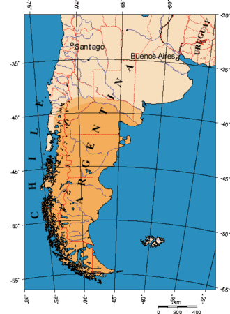
Patagonia is the southern tip of South America, shared between Argentina and Chile, an area the size of France and Spain combined with fewer people than live in Brno. The Argentine side is a vast steppe of pampa grazed by sheep and guanacos, closed off to the west by the Andes and the world's third-largest ice field. Here lies the Perito Moreno Glacier, one of the few in the world that isn't retreating, its face calving house-sized chunks of ice into the lake every few minutes. At the northern edge of the ice field, the granite towers of Fitz Roy and Cerro Torre rise above the village of El Chaltén, the continent's most famous trekking destinations. At the very southern tip lies Ushuaia, the southernmost city in the world, where ships depart for Antarctica, and on the Atlantic coast, the Valdés Peninsula with its whales, sea lions and penguins. Distances are enormous — it's a thousand kilometres from Ushuaia to El Chaltén — and flying between regions is the norm. Plan on ten to fourteen days for a first trip, in the season running from November to March.

What to see

The places worth your time in Patagonia, and what to expect at each

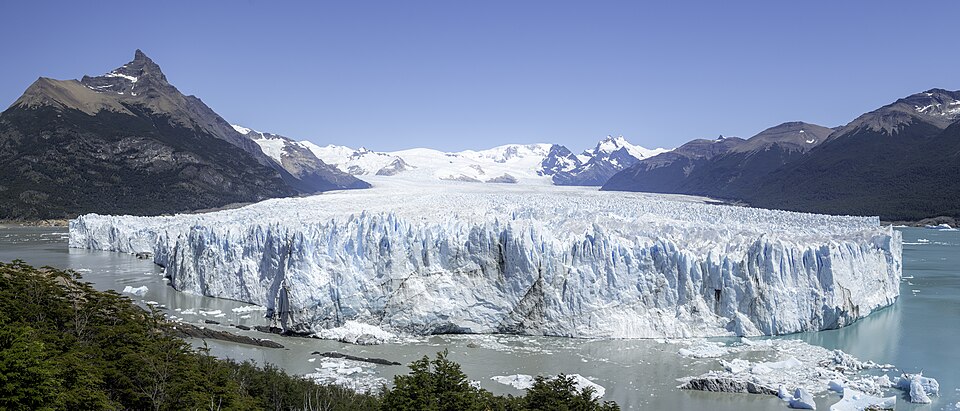
Perito Moreno Glacier

Perito Moreno Glacier

Los Glaciares National Park, 80 km from El Calafate

A glacier thirty kilometres long with a five-kilometre-wide face rising sixty to seventy metres above Lago Argentino. It advances up to two metres a day, and chunks of ice break off its face with a crack like cannon fire. Facing the glacier are four kilometres of wooden walkways with viewpoints a few hundred metres away.

Tip: Most ice calves in the afternoon, once the sun has warmed the glacier's face — arrive after lunch and wait at the southern walkways for at least two hours. Ice-cleat mini-trekking on the glacier costs over three hundred dollars and has an age limit; the one-hour Safari Náutico boat below the face is a cheaper way to experience it. Park entry is paid in pesos or by card at the gate.

Admission:
park entry around $40
Time needed:
half a day
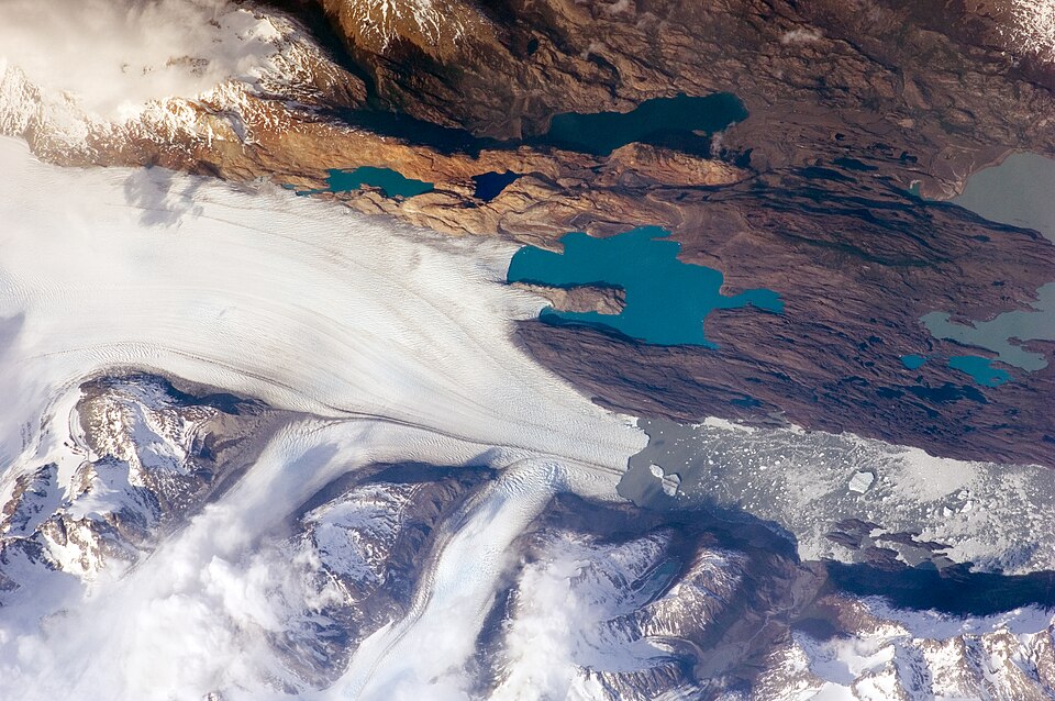
Upsala and Spegazzini Glaciers by boat

Upsala and Spegazzini Glaciers by boat

Lago Argentino

A full-day cruise along the northern arms of Lago Argentino, threading between blue ice floes to the Upsala Glacier, one of the largest in South America, and to Spegazzini, whose face, up to a hundred thirty-five metres tall, is the highest in the park. These glaciers can only be reached by boat — there's no road access.

Tip: Boats leave from Punta Bandera harbour, forty-five kilometres from El Calafate, and the trip takes a full day. Sit on the upper deck by the railing, and bring a hat and gloves — the wind off the glacier is bitter even in January. Ice floes shift with the wind, so the route can vary.

Admission:
around $150–200
Time needed:
a full day
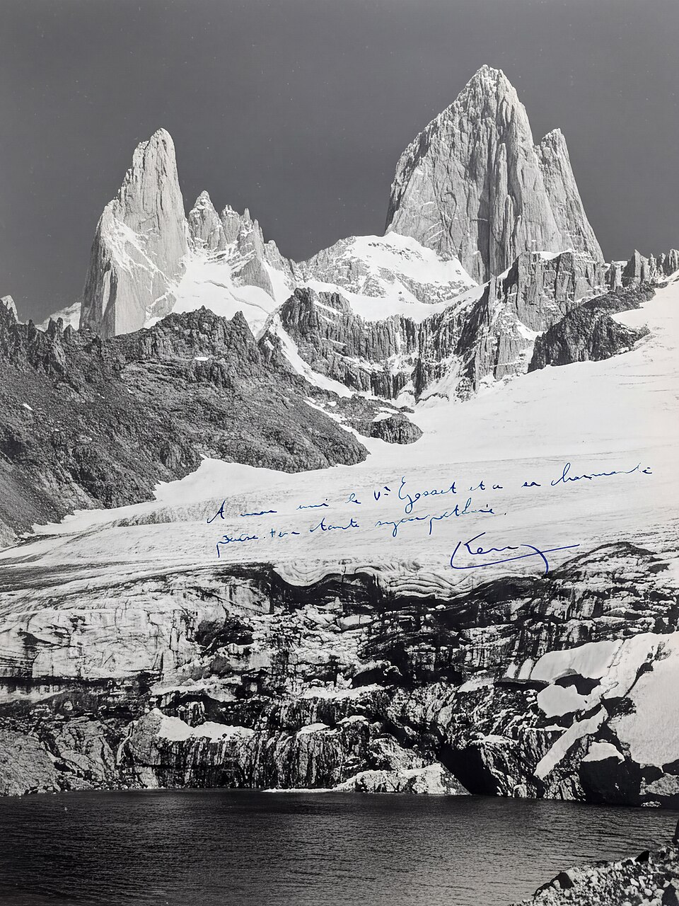
Laguna de los Tres and Fitz Roy

Laguna de los Tres and Fitz Roy

El Chaltén

Patagonia's most famous day hike: a trail leads from El Chaltén through forest and valley to Poincenot campsite, then climbs steeply four hundred metres to a glacial lake right below the granite wall of Fitz Roy (3,405 metres). Twenty to twenty-four kilometres round trip in total.

Tip: Set out in the dark around three in the morning to reach the lake for sunrise, when the towers turn red — it's the classic postcard view. The final stretch is the hardest, so allow an hour for it. Trail access in the El Chaltén sector is free. In strong wind or ice, rangers close the last climb.

Admission:
free
Time needed:
8–10 h
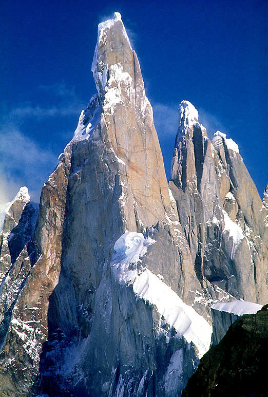
Laguna Torre and Cerro Torre

Laguna Torre and Cerro Torre

El Chaltén

El Chaltén's second classic hike, easier than Fitz Roy: eighteen kilometres round trip with only three hundred metres of elevation gain, following the Fitz Roy river valley to a glacial lake dotted with floating ice. Above it rises the slender granite spire of Cerro Torre, one of the hardest mountains in the world to climb.

Tip: Cerro Torre hides in clouds more often than Fitz Roy, so morning hours are the safest bet. From the lake, a trail continues another hour along the shore to the Maestri viewpoint, overlooking the Grande Glacier. Families do well with the shorter trail to the Cerro Torre viewpoint, a two-hour round trip.

Admission:
free
Time needed:
6–7 h
Beagle Channel

Beagle Channel

Ushuaia

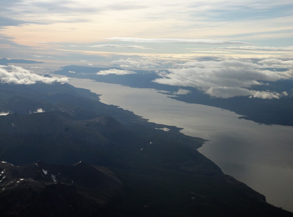
The channel between Tierra del Fuego and the Chilean islands, sailed through by Darwin's ship, the Beagle. Boats from Ushuaia head out to islets with sea lion and cormorant colonies and to the Les Eclaireurs lighthouse, often mistakenly called the 'lighthouse at the end of the world.' Beyond it, the Chilean mountains come into view.

Tip: Most boats sail three hours out to the lighthouse and the sea lion colony; longer trips continue on to Isla Martillo for the penguins. Small boats and sailboats get closer to the wildlife than the large catamarans. The sea is calmest in the morning; wind picks up in the afternoon.

Admission:
$50–80
Time needed:
3 h
Tierra del Fuego National Park

Tierra del Fuego National Park

12 km from Ushuaia

A park twelve kilometres from Ushuaia, where the Pan-American Highway ends and forest, lakes, peat bogs and sea meet beneath the mountains. Trails run along the shore of Lapataia Bay and Lake Roca, from short viewpoints to a full-day hike up Cerro Guanaco overlooking the Beagle Channel.

Tip: The Senda Costera coastal trail is the prettiest: eight kilometres through forest and along coves with no climbing, starting at the post office in Ensenada Bay, where you can get your passport stamped with the 'end of the world' mark. Minibuses run from Ushuaia to the park, along with the historic End of the World Train, which is pricey and slow.

Admission:
around $30
Time needed:
half a day to a full day
Penguins on Isla Martillo

Penguins on Isla Martillo

Beagle Channel, 85 km from Ushuaia

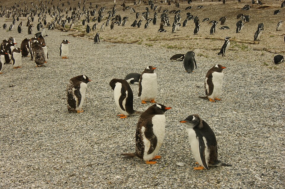
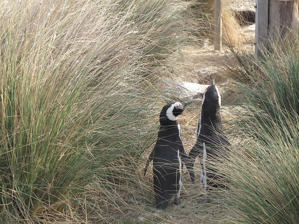
A small island in the Beagle Channel with a colony of Magellanic penguins and a few pairs of gentoo and king penguins. Only one agency is licensed to land small groups directly on the island and walk among the nests; other boats anchor offshore.

Tip: The colony is active from October to March, with the most chicks in January. The walking tour on the island has limited spots and sells out weeks ahead; boat trips along the shore usually have availability. The route from Ushuaia passes Estancia Harberton, Tierra del Fuego's oldest farm, with a marine mammal museum.

Admission:
around $150–250
Time needed:
a full day
Valdés Peninsula

Valdés Peninsula

Puerto Madryn

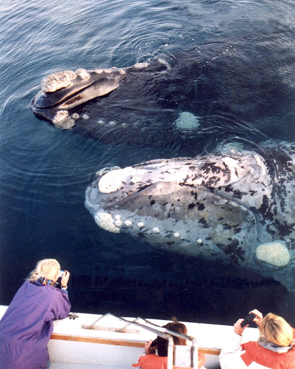
A UNESCO-listed peninsula on the Atlantic coast, where southern right whales arrive from June to December to calve and mate in sheltered bays. Elephant seals and sea lions live on the beaches, and at Punta Norte in March and April, orcas hunt sea lion pups directly from the shore.

Tip: Whale-watching boats leave from Puerto Pirámides; in September and October, calves are present and boats can approach within a few metres. Whales are also visible from the beach at Puerto Madryn itself. Orcas hunting on the beach are a rare, uncertain sight, sometimes requiring hours of waiting. The peninsula has hundreds of kilometres of gravel roads, so a car with higher clearance helps.

Admission:
reserve entry around $30, boat $80
Time needed:
1–2 days
Punta Tombo

Punta Tombo

south of Trelew

The largest Magellanic penguin colony in South America, at around half a million birds. The trail runs directly among burrows dug into the ground, with penguins crossing the path, carrying food to chicks and braying loudly. The colony sits on the Atlantic coast south of Trelew.

Tip: Penguins are present from September to April, peaking in December and January when chicks hatch. It's a hundred eighty kilometres from Puerto Madryn, a two-and-a-half-hour drive, worth combining with the Welsh tea houses in Gaiman on the way back. Don't touch the animals — keep a metre's distance.

Admission:
around $25
Time needed:
a full day

Photos: Perito Moreno Glacier — Fernando (CC BY-SA 4.0) · Upsala and Spegazzini Glaciers by boat — This image was taken by the NASA Expedition 21 crew Image acquired with a Nikon D2Xs digital camera fitted with a 400 m (Public domain) · Laguna de los Tres and Fitz Roy — Lionel Terray (CC0) · Laguna Torre and Cerro Torre — Davide Brighenti (CC BY 2.5) · Beagle Channel — Ted Wakabayashi (CC BY-SA 3.0) · Tierra del Fuego National Park — Wikimedia Commons (CC BY-SA 2.0) · Penguins on Isla Martillo — NTNU Vitenskapsmuseet (CC BY 2.0) · Valdés Peninsula — Leonardo Lanza (Public domain) · Punta Tombo — Natasha Gownaris (CC BY-SA 4.0)

Where to stay

Areas and districts, matched to the kind of trip you are taking

El Calafate

Best for: glaciers, a first base

A tourist town on the shore of Lago Argentino, with the airport, hotels, lamb restaurants and outdoor gear shops. It's the base for trips to Perito Moreno and glacier cruises. The main street, San Martín, has everything, at higher prices.

El Chaltén

Best for: trekking, mountains

A mountain village at the end of the road below Fitz Roy, founded only in 1985, with hostels, breweries and trails starting right from the street. Three to four nights is the minimum, since the mountains are often in cloud. Outside the season, almost everything closes.

Ushuaia

Best for: the end of the world, Antarctica

The southernmost city in the world, between the mountains and the Beagle Channel, with a former prison, the port for Antarctic ships, and restaurants serving king crab. The base for the national park and boat trips; in winter, the Cerro Castor ski resort.

Puerto Madryn

Best for: whales, the coast

A seaside town on the Atlantic coast, the starting point for the Valdés Peninsula and Punta Tombo. It has beaches, a waterfront and accommodation at every price point. It's busiest during whale season, from September to November.

Getting around

From the airport

Flights from Prague to Buenos Aires require one stopover, most commonly in Madrid, Rome or Frankfurt, landing at Ezeiza Airport (EZE), with a total travel time of sixteen to eighteen hours. Domestic flights into Patagonia mostly depart from the downtown Aeroparque airport (AEP), an hour's transfer away. El Calafate (FTE) is a three-hour flight, Ushuaia (USH) three and a half, and Puerto Madryn or Trelew two hours. Aerolíneas Argentinas and low-cost carriers Flybondi and JetSMART operate these routes. A direct flight between El Calafate and Ushuaia takes an hour and a quarter. El Chaltén is reached from El Calafate by a three-hour bus ride. Most EU citizens don't need a visa for Argentina.

El Calafate Comandante Armando Tola (FTE) · 20 km

  • Shuttle to the centre· 25 min· $10
  • Taxi· 20 min· $25
  • Direct bus to El Chaltén· 3 h 30 min· $40

Ushuaia Malvinas Argentinas (USH) · 5 km

  • Taxi to the centre· 10 min· $8

Puerto Madryn El Tehuelche (PMY) · 10 km

  • Taxi to the centre· 15 min· $15

Around town

Getting between regions in Patagonia means flying, since driving would take days. Within a region, long-distance buses run (El Calafate–El Chaltén several times a day), or you can rent a car — Route 40 is now mostly paved, side roads are gravel, and windscreen insurance is worth having. Glacier trips run by bus or organised tour, and boats must be booked through an agency. In El Chaltén, trails start on foot right from the village. In Ushuaia, taxis and minibuses serve the national park. Buses cross the border between Argentine and Chilean Patagonia.

Domestic flightBetween El Calafate, Ushuaia, Trelew and Buenos Aires. · $80
Long-distance busEl Calafate–El Chaltén, El Calafate–Puerto Natales. · $35
Rental carFor a flexible pace and for the Valdés Peninsula. · $70/day
Organised tourTo the Perito Moreno Glacier, with entry, transport and boat included. · $80

Useful apps: Google Maps (offline), Windy (wind), Mountain Forecast, WhatsApp

When to go

The main season runs from November to March, with long days — in December it doesn't get dark until eleven at night — and daytime temperatures of fifteen to twenty degrees. Wind is strongest in December and January. January and February are the busiest and most expensive, with villages booked solid. The best balance comes in November and from March into April, with fewer people, and in March and April the forests turn autumn colours. From May to September it's winter, and many hotels and trails in El Chaltén close, though Perito Moreno stays open year-round and Ushuaia becomes a ski destination. For whales at Valdés, go from September to November.

Best time

November–March

What to avoid

June–August (hotels and trails closed)

MonthJanFebMarAprMayJunJulAugSepOctNovDec
Day19°19°16°12°7°3°3°5°9°13°16°18°
Night7°6°4°2°-1°-4°-4°-3°-1°2°4°6°
Rainy days544455554344

Food & drink

Patagonian cuisine is built around lamb: cordero patagónico is roasted whole on an iron cross by an open fire for hours, and it's the main dish at every estancia and parrilla restaurant. In Ushuaia, people eat centolla, king crab from the Beagle Channel; on the Atlantic coast, seafood; and trout from the lakes. The region's specialty is the calafate berry, used for jams, ice cream and liqueur — legend says anyone who tastes it will return to Patagonia. El Chaltén has several small craft breweries. Prices in Patagonia run higher than in Buenos Aires, since everything has to be shipped in.

What to try

Cordero patagónico

A whole lamb roasted on an iron cross, al asador, over an open fire for five to six hours, with crackling skin. Best at estancias and parrilla restaurants in El Calafate, where a single portion costs around twenty-five dollars.

Centolla

King crab from the Beagle Channel, with long legs and sweet meat, served cold with mayonnaise, baked with cheese, or in soup. In Ushuaia restaurants you pick yours live from a tank.

Calafate

A dark blue berry from a Patagonian shrub, similar to a blueberry with a sweet flavour. Made into jam, ice cream and liqueur, and legend says whoever eats it will return to Patagonia.

Trout and merluza negra

Trout from the lakes and rivers, and merluza negra, Patagonian toothfish from the depths of the southern seas, with rich white flesh. Shrimp and octopus are also eaten on the Atlantic coast.

Empanadas

Baked or fried pastries filled with minced beef, olive and egg, or chicken, ham and cheese, or corn. Every province has its own version, and the best come from Salta and Tucumán. Eaten by hand as a snack or a cheap lunch.

Mate

An infusion of yerba mate leaves, drunk from a gourd through a metal straw. Argentinians carry it everywhere with a thermos, to the park or the office. Cafés rarely serve it — you'll only try it if invited, or by buying a set at the supermarket.

Malbec

A red wine from a grape variety brought from Cahors in France, which found its true home in the high-altitude vineyards of Mendoza. Full-bodied and fruity, ideal with beef. A bottle costs a few dollars in a shop, and even the cheapest ones are drinkable.

Dulce de leche

Milk cooked with sugar into a thick caramel paste. Found in pancakes, in alfajores biscuits, in ice cream and spread on toast at breakfast. The Havanna alfajor is the classic souvenir, but smaller bakeries make better ones.

What it costs

Los Glaciares National Park entry

around $40

Safari Náutico boat below Perito Moreno

around $50

Mini-trekking on the glacier

$300–400

Bus El Calafate–El Chaltén

$35–45

Cordero patagónico at a restaurant

$20–30

Craft beer in El Chaltén

$5–8

Boat trip on the Beagle Channel

$50–80

Night in a 3-star hotel, double

$90–180

Indicative prices that change over time — treat them as a guide, not a price list.

Practical information

SocketsCEuroplug, two round pinsIAustralian, angled pins
Voltage220V / 50Hz
Tap waterTap water is drinkable — Tap water is safe and good in El Calafate, El Chaltén and Ushuaia; in El Chaltén it runs straight from glacial streams. On national park trails, water can also be drawn from mountain streams above campsites — glacial meltwater is among the cleanest in the world. Skip bottled water and just bring a bottle to refill.
TippingTen percent is customary at restaurants, given in cash and separately, since the card terminal often can't add it. The bill may include a line for 'cubierto' or 'servicio de mesa' for bread and cutlery — that isn't a tip, it's charged on top. Taxi drivers get rounded up; loose change is left at cafés. Because of inflation, peso prices shift month to month, which is why our figures are given in dollars. Foreign Visa and Mastercard cards get an exchange rate close to the market rate, so paying by card is worthwhile; changing dollars on the street with vendors calling out 'cambio' isn't worth the risk of counterfeit notes.
Driving on theright
SafetyPatagonia is very safe, with crime in the towns close to nonexistent. The real risk is the weather: the westerly wind commonly blows at eighty to a hundred kilometres an hour and can knock a person over on the ridges, and conditions can flip from sunshine to snow within an hour even in summer. Set out on hikes in the morning, carry layers, a waterproof jacket and a hat even in January. The final stretch up to Laguna de los Tres is steep and dangerous in strong wind or ice, and rangers close it when conditions turn. Glacier access is only permitted with a licensed agency. Distances are vast and petrol stations sparse — always top up the tank when driving.
Opening hoursArgentina runs on a shifted schedule: shops open at ten, take a midday break from one to four, and close at nine. Dinner before nine marks you as a tourist — locals eat at ten. In Patagonian towns outside the season (May to September), many hotels and restaurants close, and in El Chaltén almost everything does. National parks are open during daylight hours, from eight to eight in summer.
Customs & etiquetteArgentinians greet each other with a kiss on the right cheek, even men who know each other. Conversation is fast and loud, and sharp political debate is a national pastime — don't weigh in with an opinion on the Falklands (Malvinas), a sensitive topic for Argentinians. Mate is drunk from a single gourd with one metal straw, the bombilla, passed around a circle; when you've had enough, say 'gracias' — otherwise it keeps getting refilled. Football is a religion, and the question of Boca or River deserves a considered answer.
A few local wordsHello — Buen díaThank you — GraciasHow much does it cost? — ¿Cuánto sale?The bill, please — La cuenta, por favorMedium steak — Bife a puntoGreat — Bárbaro / Genial

How to plan your days

1 day

Perito Moreno in One Day

  1. 1Morning departure from El Calafate to the national park.
  2. 2Late morning Safari Náutico boat below the glacier's face.
  3. 3Lunch at a café by the viewpoints.
  4. 4Afternoon: two hours on the walkways, waiting for the ice to calve.
  5. 5Evening cordero patagónico in El Calafate.

2 days

El Chaltén in Two Days

  1. 1Day 1: morning bus from El Calafate, afternoon hike to the Los Cóndores viewpoint above the village.
  2. 2Evening at a brewery in El Chaltén.
  3. 3Day 2: set out before dawn for Laguna de los Tres to catch sunrise over Fitz Roy.
  4. 4Rest by the lake, then descend to the village.
  5. 5Late-afternoon bus back to El Calafate.

3 days

A Three-Day Glacier Loop

  1. 1Day 1: Perito Moreno with a boat trip or mini-trekking.
  2. 2Day 2: full-day cruise to the Upsala and Spegazzini glaciers.
  3. 3Day 3: transfer to El Chaltén and hike to Laguna Torre.
  4. 4Sunset over Fitz Roy from the Los Cóndores viewpoint.
  5. 5The following day, fly to Ushuaia or continue on to Torres del Paine.

Day trips

Torres del Paine

270 km · 5–6 h by car

The most famous Chilean national park, across the border, with the granite Torres towers, the Cuernos horns and turquoise lakes. Organised full-day trips run from El Calafate with viewpoint stops, but it's twelve hours of travel plus a border crossing. Better to cross into Puerto Natales and stay two to five days for the W or O treks.

Lago del Desierto

37 km · 45 min by car

A forest lake north of El Chaltén with views of Fitz Roy from the north and of the Huemul Glacier. On the way is the Chorrillo del Salto waterfall, reachable on foot. A boat crosses the lake to the Chilean border, where a trail continues into Chile for those travelling on foot.

Estancia Cristina

90 km · 2 h by boat

A remote sheep farm at the far end of Lago Argentino, reachable only by boat through the glacial ice floes. Around the farm runs a hike or jeep ride to a viewpoint over the Upsala Glacier, and a museum on the life of the first settlers. The excursion is combined with a glacier cruise and takes a full day.

Frequently asked questions

How many days do I need for Patagonia?+

For Argentine Patagonia with the Perito Moreno Glacier, El Chaltén and Ushuaia, allow at least ten days including flights from Buenos Aires. Add the Valdés Peninsula and Torres del Paine in Chile and plan fourteen to eighteen days. A shorter trip covering just one area (El Calafate and El Chaltén) can be done in six to seven days.

When is the best time to visit Patagonia?+

From November to March. December through February have the longest days and the most services open, but also the biggest crowds and wind. November and March are quieter and cheaper. In winter, most of El Chaltén shuts down, but Perito Moreno can be visited year-round.

How difficult are the hikes around El Chaltén?+

The trails are well marked and maintained. Laguna Torre is a moderate six-hour hike, Laguna de los Tres is long with a steep, rocky final climb — for the fit. Shorter viewpoints above the village suit everyone. Weather matters most, so build in spare days.

How do you pay in Argentina?+

Cards are accepted almost everywhere and now get an exchange rate close to what you'd get in cash. Dollar cash gets changed to pesos at exchange offices; ATMs have low limits and high fees. Prices in Argentina shift quickly due to inflation, which is why we quote reference prices in dollars.

Can Argentine and Chilean Patagonia be combined?+

Yes, most commonly from El Calafate to Puerto Natales by bus, a five-hour ride across the border into Torres del Paine. Food is checked at the border — fruit, meat and dairy can't be brought into Chile. Buses also run from Ushuaia to Punta Arenas in Chile.

What should I pack to wear?+

Layers and a waterproof, windproof jacket. Even in summer it can freeze in the morning and snow on the ridges, with twenty degrees by afternoon. A hat, gloves, good hiking boots and sunglasses — the ozone hole over the south intensifies UV exposure. The wind is strong enough that an umbrella is useless.

When can I see whales at Valdés?+

Southern right whales are in the bays from June to December, peaking in September and October with calves. Orcas hunting on the beach at Punta Norte appear from February to April, but sightings aren't guaranteed. Penguins at Punta Tombo are present from September to April. Elephant seals gather on the beaches mainly in September and October.

Is it possible to reach Antarctica from Ushuaia?+

Yes, ninety percent of Antarctic expedition ships depart from Ushuaia in season, from November to March. The voyage takes ten to twelve days and costs eight to fifteen thousand dollars; cheaper last-minute deals show up at agencies in Ushuaia a few days before departure.

Requisitos de visa

Verifique los requisitos de visa actuales para ingresar a este país.

Verificar requisitos de visa

Números de emergencia

Idioma

Spanish

Moneda

ARS

Huso horario

GMT-3

Prefijo

+54

Población

46.7M

Área

2,780,400 km²

Voltaje

220V / 50Hz

Lado de conducción

Derecha

Mejores hoteles en Patagonia

Precios en vivo de 500+ propiedades

Cargando hoteles...

More destinations in Argentina

Planea un viaje a Patagonia?

Compare cientos de hoteles, encuentre el mejor precio y reserve con cancelación gratuita.